Weather
Louisiana braces for more heavy rainfall as millions are under flash flood watches across the South
Key Points
Louisiana is bracing for more heavy rainfall that could lead to damaging flash flooding across the state. Around 10 million people across Texas, Louisiana, Alabama, Mississippi, Georgia and the Florida Panhandle are under flash flood watches Friday. The remnants of Tropical Storm Arthur are continuing to bring heavy rainfall and life-threatening flash flooding to the Southeast, including Louisiana and Mississippi.
Louisiana is bracing for more heavy rainfall that could lead to damaging flash flooding across the state.
Around 10 million people across Texas, Louisiana, Alabama, Mississippi, Georgia and the Florida Panhandle are under flash flood watches Friday.
The remnants of Tropical Storm Arthur are continuing to bring heavy rainfall and life-threatening flash flooding to the Southeast, including Louisiana and Mississippi.
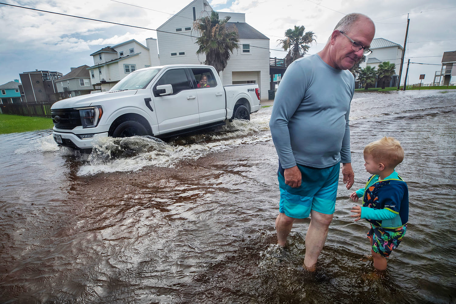
Earlier this week, Louisiana residents reported downed trees, heavy rain and strong winds. NBC News teams on the ground saw knee-deep floodwaters, flipped-over train cars and destruction to buildings.
Arthur is expected to emerge over the Atlantic Ocean on Friday afternoon and has a 10% chance of regaining strength the next few days. Even if that happens, it will be moving away from the coast with no additional impacts expected.
On Friday, slow-moving storms will be capable of producing 2 to 3 inches of rainfall per hour, which will likely result in additional flash flooding. Cities under a moderate risk for flooding include Hattiesburg and Biloxi in Mississippi and Mobile and Dothan in Alabama, where additional rainfall totals through Saturday may reach 4 to 6 inches.
In Louisiana, the state record for a 24-hour rainfall is 22 inches. Preliminary rainfall totals predicted so far include 29 inches in Cottonport, 22 inches in Plaucheville and 17 inches in Simmesport near the Atchafalaya River.
If the preliminary numbers are verified, Friday’s rainfall will set a new 24-hour record for the state.
Rainfall totals elsewhere in the South include a foot of rain in Perkinston and Black Creek, Mississippi, and 11 inches in Village Mills, Texas.
Weekend severe storms
The severe risk returns to the Great Plains on Saturday and parts of the Midwest again by Sunday.
On Saturday, much of Nebraska, Kansas and eastern Colorado will be at risk for storms capable of producing wind gusts up to 75 mph, hail measuring 2 inches or more in diameter and a few tornadoes.
There will also be a flood risk for these areas, with a flood watch in place from northeast Kansas into northern Missouri. Cities to watch include North Platte and Lincoln in Nebraska; Salina and Wichita in Kansas; and Kansas City, Missouri.
On Sunday, 12 million people are at risk for severe storms from eastern Colorado to central Illinois. All hazards are possible, and cities to watch include Wichita; Oklahoma City; Tulsa, Oklahoma; and St. Louis.
Heat and humidity in the South
Heat alerts are in effect for 41 million people across the southern Plains, the Deep South and the southern half of Florida.
South Texas can expect dangerous heat index values of 110 to 120 degrees Fahrenheit, while South Florida can expect values of 105 to 110. The heat index describes what the temperature feels like to the human body.
High temperatures over the weekend are expected to reach around 93 in Houston and Miami and 92 in New Orleans.
Louisiana (LOCATION)
South Louisiana (LOCATION)
Texas (LOCATION)
Alabama (LOCATION)
Mississippi (LOCATION)
Georgia (LOCATION)
Florida (LOCATION)
Southeast (LOCATION)
NBC News (ORG)
Arthur (PERSON)
the Atlantic Ocean (LOCATION)
Hattiesburg (LOCATION)
Biloxi (LOCATION)
Mobile (LOCATION)
Dothan (LOCATION)