
Science
Scientists find vast hidden water reserves beneath Oregon’s volcanic Cascades
Key Points
Beneath the forested slopes of Oregon’s Cascade Range, scientists have uncovered a vast, hidden reservoir of water locked inside volcanic rock. By analysing temperature data from geothermal drill holes, a University of Oregon-led team estimated that at least 81 cubic kilometres of water are stored in the region’s subsurface, nearly three times the capacity of Lake Mead, the largest reservoir in the United States. The discovery, announced by the university, reshapes how researchers think...
Beneath the forested slopes of Oregon’s Cascade Range, scientists have uncovered a vast, hidden reservoir of water locked inside volcanic rock. By analysing temperature data from geothermal drill holes, a University of Oregon-led team estimated that at least 81 cubic kilometres of water are stored in the region’s subsurface, nearly three times the capacity of Lake Mead, the largest reservoir in the United States. The discovery, announced by the
university, reshapes how researchers think about water storage in volcanic mountains and could have implications for everything from regional water budgets to volcanic hazard assessment.
A surprise hidden in old drill dataThe finding did not come from new drilling or expensive field campaigns, but from a fresh look at existing data. The team, led by University of Oregon geosciences professor Leif Karlstrom, focused on temperature measurements collected from geothermal exploration wells drilled decades ago across the Oregon Cascades.
These drill holes were originally used to assess geothermal energy potential, not to map groundwater. But the researchers realised that the way heat moves through rock is strongly influenced by whether the pores and fractures are filled with air or water. Water conducts heat differently than dry rock, and those differences leave a detectable signature in temperature profiles.
By modelling how heat should flow through dry volcanic rock and comparing it to the actual temperature logs, the scientists could infer where large volumes of water must be present.The result was a surprising picture of the subsurface: instead of mostly dry, fractured lava flows, the team found evidence for a regionally extensive, water-saturated zone stretching across a large portion of the Oregon Cascades.
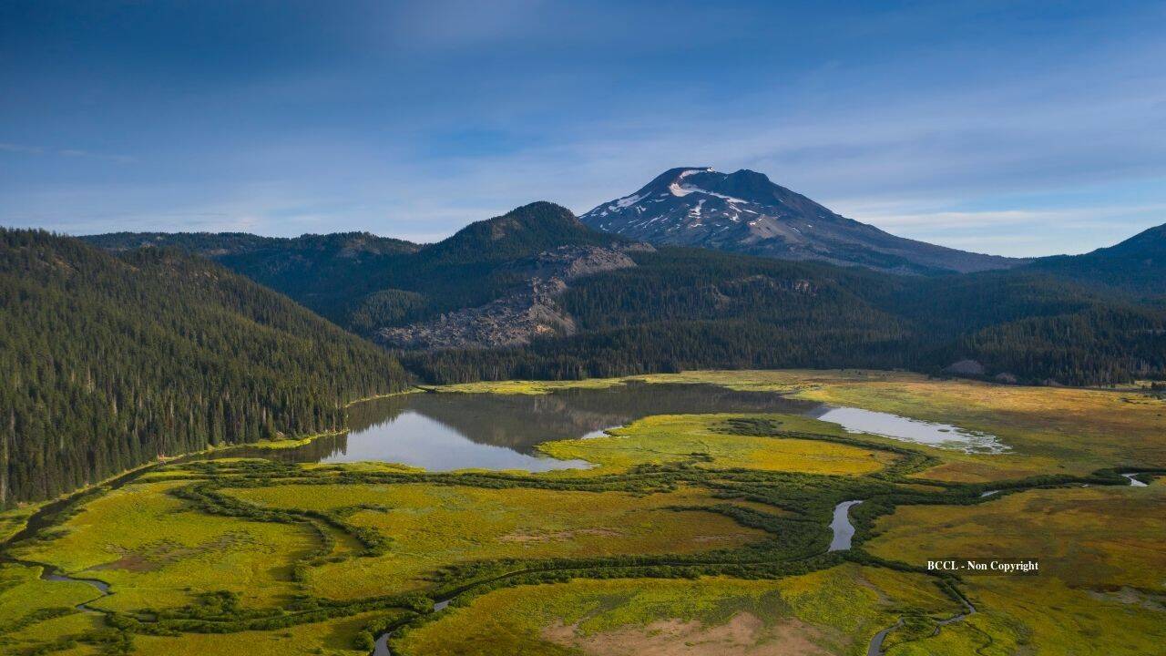
How much water are we talking about?Oregon’s Cascade RangePhoto: Canva
The team’s calculations suggest that at least 81 cubic kilometres of water are stored in the volcanic rocks of the study area. To put that in perspective, Lake Mead, the massive reservoir formed by Hoover Dam on the Colorado River, has a full capacity of about 28 cubic kilometres. In other words, the hidden aquifer beneath the Oregon Cascades could hold nearly three times as much water as the largest reservoir in the U.S.This does not mean there is an underground “lake” that could be tapped like a surface reservoir. The water is dispersed through countless pores, fractures and vesicles (gas bubbles) in layers of lava flows, volcaniclastic deposits and other volcanic rocks. It is more like a giant, three-dimensional sponge than a single body of standing water.
Why volcanic mountains can store so much waterVolcanic terrains are unusually good at storing groundwater. Repeated eruptions build up thick stacks of lava flows, ash layers and fragmented volcanic deposits. As these materials cool and weather, they develop: Porous zones where gas bubbles were trapped in solidifying lava; fracture networks created by cooling, tectonic stress and later erosion; and permeable layers of volcanic breccia and sediment between harder flows.
In wet, high-elevation environments like the Oregon Cascades, abundant precipitation from rain and snowmelt can infiltrate deeply into these rocks. Eventually, this forms large saturated zones which can last for long periods, even during dry summers or multi-year droughts.
Many previous models assumed that a large fraction of water in volcanic mountains either drained rapidly through fractures or was stored primarily in shallow soils and alluvial valleys. The new results indicate that a much larger fraction is stored in the volcanic bedrock itself, with important implications for water movement through the landscape.
Implications for water budgets and drought resilienceThis finding raises a key question for water managers and hydrologists: How much of the precipitation that falls on the Cascades is stored in these deep volcanic aquifers, and how slowly is it released? If a significant portion of runoff is buffered by this hidden storage, it could mean that streams and springs are more resilient to drought than previously thought, supported by slow drainage from the volcanic aquifer. It also suggests that regional water budgets may need to be revised to account for larger subsurface storage and longer residence times. And climate change impacts on streamflow could be moderated, at least temporarily, by the slow release of water from these deep reservoirs.
At the same time, the study underscores how little is still known about groundwater in many mountainous regions. The Oregon Cascades are relatively well studied compared to other ranges, yet a water store of this magnitude remained undetected until now.
Connections to volcanic hazardsThe findings also matter for volcanology. Water plays a critical role in how volcanoes behave.When magma rises through wet crust, it can interact with groundwater, potentially triggering explosive eruptions or hydrothermal activity.
Knowing that large volumes of water are stored in the volcanic edifice itself helps scientists better model: How heat and fluids move beneath active volcanoes; where hydrothermal systems are likely to form; and how eruptions might interact with subsurface water to produce phreatic or phreatomagmatic explosions.
While the study does not change the overall hazard profile of Oregon’s volcanoes, it adds an important piece to the puzzle of how these systems are plumbed.
A new way to “see” groundwaterOne of the most powerful aspects of this work is the method itself. Instead of relying solely on traditional groundwater monitoring wells, which are sparse in remote mountain areas, the team used existing geothermal temperature logs as a kind of indirect imaging tool.
This approach could be applied in other volcanic regions around the world, from the Andes to the Japanese archipelago, where similar stacks of lava flows and abundant precipitation may hide large aquifers. It offers a relatively low-cost way to refine estimates of subsurface water storage in places where drilling new wells would be prohibitively expensive.
What this means for the Oregon CascadesFor the Oregon Cascades, the study suggests that the landscape’s water cycle is more complex and more buffered than previously recognised. The forests, meadows and rivers that define the region are underpinned by a vast, slow-moving reservoir that helps regulate flow through wet and dry periods.
The researchers emphasise that this is a minimum estimate; the true volume could be larger as more data are analysed and models are refined. Future work will likely focus on: Integrating the temperature-based estimates with streamflow, geochemical and seismic data; mapping how the aquifer varies across different volcanic centres and rock types; assessing how climate change might affect recharge and long-term storage in these systems.
A hidden resource with big questionsThe discovery of 81 cubic kilometres of water beneath the Oregon Cascades is a reminder of how much remains unknown about Earth’s subsurface. While this water is not a direct source of drinking water or irrigation in the conventional sense, it plays a crucial role in sustaining ecosystems, streams and potentially even geothermal resources. As scientists continue to probe these hidden reservoirs, the challenge will be to understand not just how much water is there, but how it moves, how it interacts with surface systems and how it might respond to a warming, changing climate.