
Weather
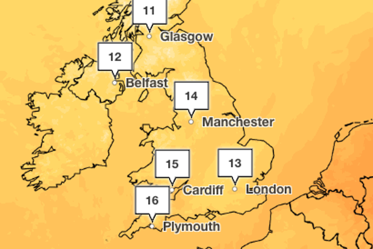
Autumn finally arrives as colder temperatures to sweep UK this week
Key Points
Autumn finally arrives as colder temperatures to sweep UK this week Temperatures will plunge to the low to mid teens later this week as cold wind moves in from the north west - Bookmark - CommentsGo to comments Become an Independent member to bookmark this article Already a member? Log in Autumn is finally set to arrive in the UK this week after a record-breaking summer of extreme heat and dry weather. Temperatures are expected to drop from the low twenties to the mid-teens from as early as...
Autumn finally arrives as colder temperatures to sweep UK this week
Temperatures will plunge to the low to mid teens later this week as cold wind moves in from the north west
- Bookmark
- CommentsGo to comments
Become an Independent member to bookmark this article
Already a member? Log in
Autumn is finally set to arrive in the UK this week after a record-breaking summer of extreme heat and dry weather.
Temperatures are expected to drop from the low twenties to the mid-teens from as early as Tuesday as cold air sweeps in from the North West, bringing rain and chilly winds.
Wednesday could be the first day since June that temperatures stay below 20C across the whole of the country, according to the Met Office, as heavy rain covers much of the UK.
But the colder spell will be short-lived, with temperatures set to rise back to around 19C in the South East on Friday.
Autumnal conditions will begin for parts of the UK on Tuesday as a band of wind and rain moves across Scotland and Northern Ireland. Cloudy conditions are expected across the rest of the country, with highs of 22C in the South East but just 13C in the north of England.
Temperatures will drop dramatically on Wednesday, with highs of 16C in parts of the South East and South West. Heavy rain will move east across the country over the course of the day, with sunny spells expected in Scotland and Northern Ireland.
Thursday will see a chilly start, with mist and fog and patches of frost in places. Conditions will stay changeable on Thursday and Friday, according to the Met Office, with spells of rain expected as well as some brighter patches.
Temperatures will remain cool on Thursday, but climb up to the high teens on Friday.
The weekend is expected to see temperatures in the low- to mid-teens, with some sunny spells and cloud.
It comes after the UK recorded its joint-fourth warmest September ever, according to provisional figures from the Met Office.
The maximum temperature was as high as 28.1C on 29 September, the forecaster said, level with September figures from 1949 and 2016.
This was around 2C cooler than the joint-warmest Septembers on record, recorded in 2006 and 2023.
Experts have said wet and stormy conditions in autumn could develop into an icy winter as the “super El Niño” becomes the strongest in history.
El Niño is a naturally occurring climate phenomenon that develops in the tropical Pacific Ocean. It takes place when sea-surface temperatures across the central and eastern Pacific become significantly warmer than average, altering atmospheric circulation patterns and influencing weather around the globe.
Met Office five-day forecast
Tuesday
Sunny spells and scattered showers across Scotland, and feeling cool here. Cloudy across northern England Wales and the Midlands with showery outbreaks of rain. Warm sunny spells in the South East.
Wednesday
Heavy rain will slowly move east across England and Wales on Wednesday. Sunny spells and scattered showers in Northern Ireland and Scotland. Turning cooler across the UK.
Thursday to Saturday
Changeable over the next few days with spells of rain at times or heavy showers. Some drier and brighter intervals too, and feeling cooler than of late.
Join our commenting forum
Join thought-provoking conversations, follow other Independent readers and see their replies
Comments
[Image text:] 11
12
Glasgow
Belfast
14
Manchester
15
13
16
Cardiff
Plymouth
London