
Science
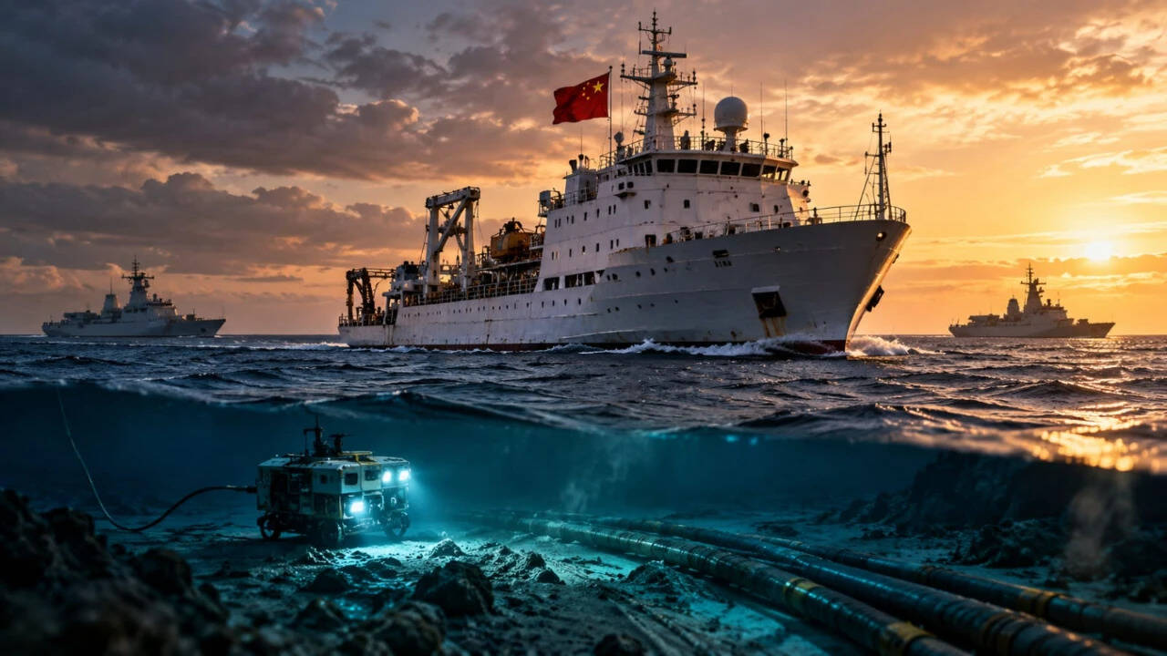
China’s Grey-Zone Maritime Pressure: Research fleet tests Taiwan
Key Points
Chinese military aircraft and vessels appearing around Taiwan have become a near-daily reminder for the island's military to remain alert to Beijing's next move. But beyond warships and fighter jets, another category of vessels is drawing growing scrutiny: Chinese research ships that operate in waters around the island under the stated purpose of conducting scientific surveys. A Reuters investigation published on October 8 reported the first known sighting of a Chinese maritime militia...
NEW DELHI: Chinese military aircraft and vessels appearing around Taiwan have become a near-daily reminder for the island's military to remain alert to Beijing's next move. But beyond warships and fighter jets, another category of vessels is drawing growing scrutiny: Chinese research ships that operate in waters around the island under the stated purpose of conducting scientific surveys.
A Reuters investigation published on October 8 reported the first known sighting of a Chinese maritime militia fishing boat off Taiwan's Pacific coast, operating alongside a coast guard cutter and a research vessel. The report added to Taipei's longstanding concerns about what it describes as China's "grey-zone harassment", a pattern of activity that falls short of open warfare but can steadily challenge Taiwan's maritime control and exhaust its surveillance resources.
The concern is that some ostensibly civilian research operations may also generate information useful to the People's Liberation Army (PLA), including data on seabed topography, underwater conditions and critical infrastructure. Such information can have legitimate scientific applications, but it can also be relevant to submarine operations and undersea warfare planning.
The question facing Taiwan is whether Beijing is using scientific research, maritime law enforcement and civilian vessels as part of a broader strategy to increase pressure on the island without triggering an outright military confrontation.
What is grey-zone harassment, and why does Taiwan use the term?Grey-zone activity refers to actions that apply pressure on an opponent without crossing the clear threshold of armed conflict. These can include coast guard patrols, surveillance, fishing fleets linked to state agencies, seabed surveys and demands that commercial ships comply with another country's claimed authority.
China is using research ships, coast guard vessels and suspected militia boats to pressure Taiwan without open conflict.
Taiwan argues that China is combining these activities to challenge its control over surrounding waters. Beijing considers Taiwan part of its territory and maintains that its activities are lawful. Taipei rejects China's sovereignty claims.
In his August 18, 2026, report,
Science as Statecraft: Chinese Research Vessel Operations Around Taiwan, Allen Zhang of The Heritage Foundation argues that Chinese research ships could help Beijing gather maritime intelligence while giving its operations a civilian appearance.
The report identifies four potential strategic uses:
- Seabed mapping: Collecting information about underwater terrain and ocean conditions that can affect submarine operations.
- Undersea cable intelligence: Identifying the location and vulnerability of cables carrying internet and communications traffic.
- Surveillance: Observing military exercises and the movements of Taiwanese or allied forces.
- Maritime claims: Repeatedly operating in contested waters to create an impression that China exercises authority there.
These are potential uses and strategic assessments. A vessel's presence in an area does not, by itself, prove that it is conducting military intelligence operations.
Why research vessels matter to military plannersResearch ships can carry sonar equipment, seabed-mapping systems, oceanographic sensors, remotely operated vehicles and other instruments. These technologies have legitimate scientific uses, but the resulting data can also be useful to naval forces.
Water temperature, salinity, currents and seabed topography influence how sound travels underwater. This affects the detection of submarines and the performance of sonar systems. Detailed environmental data can therefore help navies assess where submarines may operate or be detected.
Seabed surveys can also reveal terrain around submarine cables and other underwater infrastructure. Such information can be relevant to infrastructure protection, repair planning and military contingency planning.
A research vessel positioned near a military exercise may be able to observe vessel movements and collect environmental or other data. Whether a particular ship has done so requires evidence beyond its location alone.
The Heritage Foundation says China's Ministry of Natural Resources (MNR) operates the largest share of the country's maritime research fleet, which it describes as the world's largest. The report examines institutional links between civilian maritime research and China's military establishment, including research vessels that were previously registered with the People's Liberation Army Navy (PLAN).
These links are relevant to China's broader military-civil fusion strategy, which seeks to integrate civilian research, technology and industrial capacity with national defence. They do not establish that every research voyage has a military purpose.
Date-wise timeline: Chinese maritime activity around Taiwan2024: Xiang Yang Hong 06 and seabed-mapping concerns
The Heritage Foundation says the Chinese research vessel
Xiang Yang Hong 06 was observed moving slowly in precise lines along Taiwan's east coast. Naval experts cited by the paper considered the pattern consistent with seabed mapping.
Such movement can be consistent with systematic surveying, although it does not independently establish the ship's precise mission.
May 7, 2026: Taiwan challenges the Tongji
Taiwan's coast guard said it detected the Chinese research vessel
Tongji about 29 nautical miles southeast of Taiwan's southern tip. The ship was seen lowering ropes into the water, which Taiwanese authorities suspected were connected to survey instruments.
A suspected militia fishing boat, coast guard cutter and research vessel were spotted near Taiwan in August.
A Taiwanese coast guard vessel moved close to the ship and broadcast warnings. Taiwan said
Tongji retrieved its equipment and changed course.
Reuters published its report on May 11. China did not immediately respond to a request for comment.
June 6-10, 2026: Chinese agencies conduct a maritime enforcement operation
The International Institute for Strategic Studies (IISS) reported a joint Chinese operation involving the China Coast Guard, Maritime Safety Administration and transport ministry's Rescue and Salvage Bureau.
According to IISS, Chinese vessels hailed commercial ships, remotely inspected 198 vessels and questioned three about their ports of departure and arrival and the number of crew aboard. The three vessels were flagged in Benin, Liberia and Singapore.
Taiwan said the operation sought to create a false impression of Chinese jurisdiction over waters east of the island.
June 16, 2026: Xiang Yang Hong 22 conducts a marine survey
The Heritage Foundation says the research vessel
Xiang Yang Hong 22, operating under China's East China Sea Bureau, conducted a survey east of Taiwan. The stated purpose was to understand ecological conditions and support marine conservation.
The report places this activity within the broader increase in Chinese research operations around the island.
June-July 2026: Coast guard patrols expand east of Taiwan
IISS reported Chinese coast guard patrols east of Taiwan in June, followed by further patrols in July, August and September.
The broader concern is that Beijing is relying on a range of state agencies rather than exclusively on the navy. Civilian and law-enforcement vessels can maintain a presence without sending the same immediate military signal as a large naval deployment.
July 17-23, 2026: Lanhai 201's survey raises questions
The Chinese research vessel
Lanhai 201, operated by the East China Sea Fisheries Research Institute, conducted a survey east of Taiwan. Chinese authorities described it as fisheries-resource research.
On July 23, Taiwan's coast guard said the vessel was 53 nautical miles east-northeast of Lanyu, also known as Orchid Island, travelling north at 13.5 knots. Taiwan said its patrol vessel continued monitoring the ship.
The Heritage Foundation later pointed to unusual speed and course changes in publicly available tracking data as grounds for questioning whether the voyage was limited to fisheries research. That is an assessment of the vessel's behaviour, not proof of a covert military mission.
August 10-31, 2026: China conducts a seabed survey east of Taiwan
China's Ministry of Natural Resources conducted a survey intended to examine the geology and structural characteristics of the seabed, according to Chinese state broadcaster CCTV in a report cited by Reuters on September 3.
Taiwan's coast guard monitored the operation and rejected Beijing's claim to jurisdiction over the surrounding waters. China presented the survey as part of resource management and territorial planning.
Mid-August 2026: Three-vessel group spotted off Taiwan's east coast
A surveillance report by Taiwan's Apex Aviation, reviewed by Reuters, identified three vessels operating within roughly a 10-nautical-mile radius more than 30 nautical miles off Hualien.
The vessels were:
- Minfudingyu 07902, identified as a Chinese fishing boat that doubles as a maritime militia vessel.
- China Coast Guard cutter 2502.
- Research vessel Xiang Yang Hong 03.
Two Taiwanese officials confirmed the vessels' presence. They said the fishing boat was part of China's maritime militia and was operating in coordination with coast guard activity.
The surveillance did not establish the exact mission of each vessel or conclusively prove coordination among all three.
September 3, 2026: Beijing acknowledges the August survey
Reuters reported China's announcement that its Ministry of Natural Resources had surveyed waters east of Taiwan from August 10 to 31. China said the work would support a unified map for territorial planning and resource management.
China's coast guard also announced a routine patrol east of Taiwan on September 3, described by Reuters as the third such patrol since June.
October 8, 2026: Reuters reports the militia boat sighting
Reuters published its investigation into the August sighting of the suspected Chinese maritime militia fishing boat off Taiwan's east coast.
Taiwan's defence ministry said China was using law enforcement and scientific research as cover for harassment and to create an illusion of de facto jurisdiction. China's Taiwan Affairs Office and defence ministry did not respond to Reuters' requests for comment.
The report brought renewed attention to the overlap between Chinese research vessels, coast guard ships and suspected maritime militia craft.
Why Taiwan's east coast mattersTaiwan's east coast faces the Pacific and is important to its ability to receive supplies and support from partners during a crisis. The western side of the island faces mainland China across the Taiwan Strait, while its eastern maritime approaches offer access to the wider Pacific.
The Heritage Foundation identifies three underwater regions around Taiwan where Chinese research vessels have been observed since June 2026:
- Okinawa Trough, north of Taiwan: An underwater region between Taiwan and the Ryukyu island chain.
- Huatung Basin, east of Taiwan: An area relevant to understanding the seabed and ocean conditions off Taiwan's Pacific coast.
- Luzon Trough and Manila Trench, south of Taiwan: Underwater features near routes linking the South China Sea and the western Pacific.
The report says the vessels had not surveyed the Taiwan Strait during the period it examined. Their activity instead covered areas north, east and south of the island.
The wider geographic spread is part of the concern. Surveys of the approaches around Taiwan could provide information relevant to monitoring and operating in the waters surrounding the island.
What coral reefs and artificial islands have to do with China's maritime strategyCoral reefs and seabed surveys are related to the wider picture of China's maritime ambitions, but they should not be confused with the specific research-vessel incidents east of Taiwan.
In the South China Sea, China has used dredging and land reclamation to expand its presence on disputed reefs. These projects can create space for runways, ports, radar systems and other infrastructure. A reef that was previously difficult to occupy can become a fixed base for maritime surveillance and military operations.
Taiwan monitored or challenged Chinese research vessels, including Tongji and Lanhai 201, over suspected survey activities
A Reuters investigation published on October 2, 2026, reported that construction of a runway on Antelope Reef in the Paracel Islands was well underway. Satellite imagery dated September 25 showed ground preparation, gravel piles, compaction equipment and a gravel barge heading towards a newly built wharf.
Analysts cited by Reuters estimated that the runway could be completed by mid-2027. China has not acknowledged that it is building a new military base there. Chinese state media have described Antelope as serving civilian purposes, including weather forecasting, maritime services and scientific research.
The Paracel Islands are also claimed by Vietnam and Taiwan. China has occupied the islands since driving out forces of then-South Vietnam in a 1974 battle.
The relevance to Taiwan is strategic rather than geographical. Antelope Reef is in the South China Sea, not off Taiwan's east coast. The project illustrates how infrastructure initially described in civilian or scientific terms can also improve a state's ability to monitor and operate across contested maritime areas.
For Taiwan, the concern is that surveys, patrols and fixed infrastructure could reinforce one another: research ships collect data, coast guard vessels maintain a presence, and bases elsewhere in the region support longer deployments.
Undersea cables: A potential vulnerability in a Taiwan crisisTaiwan depends on undersea fibre-optic cables for international internet and communications links. These cables are difficult to monitor continuously and can be damaged by accidents, fishing activity or deliberate interference.
The Heritage Foundation's report argues that research vessels could help identify cable routes and surrounding seabed conditions. It also cites two cable outages affecting Taiwan's Matsu Islands in February 2023, when Taiwan accused China of severing the links. Those accusations should not be treated as proof that the cables were deliberately cut by China.
The paper also points to a deep-sea cable-cutting device unveiled by a Chinese research institute in 2025, which Chinese scientists said was intended for marine resource development. The report says the device was designed to operate at depths of up to 4,000 metres.
The strategic concern is that damage to multiple cables during a crisis could disrupt communications and complicate coordination with external partners. However, the existence of a capability does not establish that it has been deployed against Taiwan.
The blockade scenario: How grey-zone activity could help BeijingTaiwanese officials are concerned that China could use repeated patrols and inspections to prepare for a potential maritime blockade or quarantine.
A blockade would involve restricting access to Taiwan's ports and sea routes. A quarantine could instead be presented as a law-enforcement operation, with Chinese authorities demanding that commercial vessels provide information, submit to inspections or comply with Chinese instructions.
The distinction matters because a law-enforcement operation may be more difficult to treat as an immediate military attack than a naval blockade. It could also force Taiwan and its partners to decide how to respond to individual incidents without escalating into armed conflict.
The Heritage Foundation identifies three ways the current activity could contribute to such a scenario:
- Operational familiarity: Repeated deployments can improve knowledge of sea routes, vessel movements and operating conditions.
- Administrative pressure: Demands for shipping information can test whether Beijing can make commercial operators comply with its claims.
- Normalisation: Regular patrols may gradually make a Chinese presence appear routine, even where Taiwan disputes China's authority.
These are potential strategic benefits identified by the report, not evidence that Beijing has decided to impose a blockade.
Why Taiwan cannot simply drive every vessel awayResearch vessels are not necessarily warships. They may be conducting legitimate scientific work, and their presence outside restricted waters does not automatically establish an unlawful act.
That creates a difficult response problem for Taiwan. Forcefully expelling a civilian vessel could give Beijing grounds to accuse Taipei of obstructing legitimate research. Allowing repeated operations to continue without a response could, in Taiwan's view, encourage further activity.
Taiwan has responded through coast guard patrols, warnings, surveillance and the monitoring of vessel movements. The Apex Aviation operation also shows how civilian surveillance capabilities can contribute to maritime awareness. Its aircraft used radar, infrared imagery and automatic identification system data to document the August vessel group.
The United States has also expressed concern about Chinese activity east of Taiwan. On October 10, the US State Department described the activity as “deeply destabilising” and urged Beijing to stop pressuring Taiwan and engage in dialogue with its democratically elected authorities.
What the evidence establishes, and what remains uncertainThe reported incidents establish that Chinese research vessels and other state-linked maritime actors have been operating around Taiwan, including in areas east of the island. Taiwan has monitored or challenged some of these operations, while China has publicly described at least some surveys as scientific or resource-management work.
The evidence does not establish that every research vessel is conducting military surveillance, that the three vessels seen off Hualien were carrying out a confirmed joint mission, or that China is preparing to launch a blockade imminently.
The stronger conclusion is that Beijing's maritime presence is becoming more varied, combining research activity, coast guard operations and suspected maritime militia deployments. That combination could provide China with information, persistence and political leverage while making it harder for Taiwan to determine which activities require a stronger response.
The next indicators to watch are whether Chinese research ships return to the same underwater regions, whether coast guard patrols become more regular, whether commercial ships face more demands for information, and whether new surveillance or infrastructure activity appears along Taiwan's eastern approaches.
.
China (LOCATION)
Grey-Zone Maritime Pressure: (ORG)
Taiwan (LOCATION)
Chinese (ORG)
Beijing (LOCATION)
Pacific coast (LOCATION)
coast guard (ORG)
Taipei (LOCATION)
the People's Liberation Army (ORG)
PLA (ORG)
coast guard vessels (ORG)
Chinese Research Vessel Operations (ORG)
Allen Zhang (PERSON)
The Heritage Foundation (ORG)
Taiwanese (ORG)