
Weather
Met Office issues verdict on where snow will fall in the UK this week
Key Points
Met Office issues verdict on where snow will fall in the UK this week Temperatures have plummeted across the UK - Bookmark - CommentsGo to comments Become an Independent member to bookmark this article Already a member? Log in As temperatures plunge in an autumn chill across the UK, the Met Office has issued its verdict on whether snow is on the way. The country saw a chilly and foggy start to the week on Monday, with many waking up to temperatures as low as 3C in the south of England and...
Met Office issues verdict on where snow will fall in the UK this week
Temperatures have plummeted across the UK
- Bookmark
- CommentsGo to comments
Become an Independent member to bookmark this article
Already a member? Log in
As temperatures plunge in an autumn chill across the UK, the Met Office has issued its verdict on whether snow is on the way.
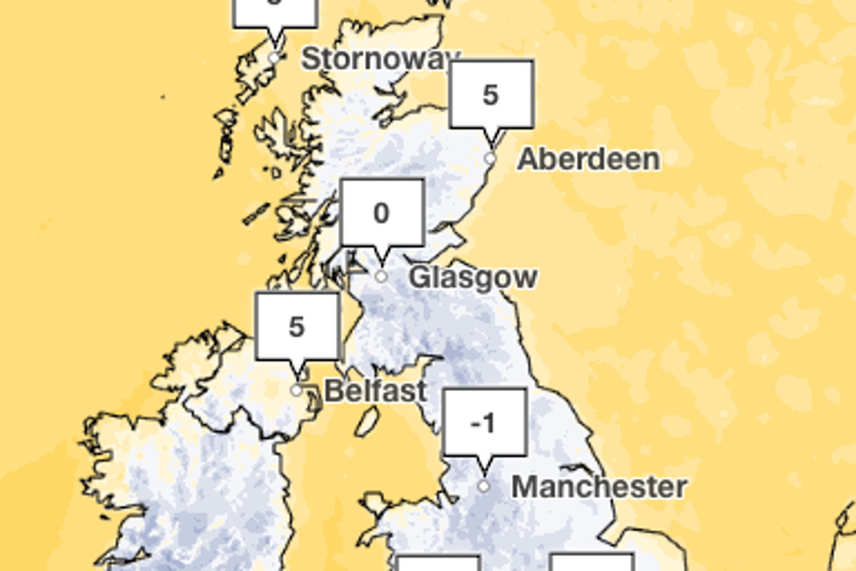
The country saw a chilly and foggy start to the week on Monday, with many waking up to temperatures as low as 3C in the south of England and -3C in parts of Wales.
Forecasters have warned the coming week could see rain and fog persist across much of the country as clear skies invite misty conditions and frost across central and northern areas.
But cloudier, breezier and milder conditions are expected to spread across southern parts, with rain arriving on Tuesday in the south and pushing up towards the north later in the week.
The Met Office has said some snow is possible later on in the week. It will be limited to high ground in the far northeast of the country.
Met Office chief meteorologist Jason Kelly said: "Snow showers could briefly fall on lower ground in the far northeast of Scotland, mainly Shetland, overnight on Wednesday and into Thursday.
“However, snow may only settle on higher ground. Snow can fall in the far northeast from late October to May, so this is not unusual for the time of year."
It comes as forecasters warn frosty conditions will become “increasingly widespread” towards the end of the week as the mercury plunges to around 1C in parts of Yorkshire on Friday morning, and closer to 4C in the south east.
“High pressure will initially dominate, leading to widely settled conditions and overnight frost,” the Met Office said. “A few showers will be possible, particularly in northern and western Scotland, and perhaps along some North Sea coasts for a time.
“Later in the weekend, a transition to more unsettled conditions is expected as bands of rain, and associated areas of low pressure, arrive from the North Atlantic, bringing more widespread wet and windy weather.”
They added: “It is likely to remain fairly changeable through the remainder of the period, with occasional rain interspersed with brighter, showery spells. Whilst colder conditions will be possible at times, especially at first, it will often be mild, with temperatures near or a little above average for the time of year.”
Met Office five day forecast
Today:
Fog slowly lifting through the morning, though some patches may linger into early afternoon across parts of central England and Wales. Otherwise, largely dry with sunny spells for many. Showers near eastern coasts will gradually fade. Feeling chilly.
Tuesday:
Cloud and rain gradually push north across parts of England and Wales, locally heavy in the southwest later. Elsewhere, many areas stay dry with bright spells after slow clearing fog.
Outlook for Wednesday to Friday:
Spells of rain continue across the south through midweek. Colder conditions develop further north with showers, some turning wintry. Frosts become increasingly widespread later.
Join our commenting forum
Join thought-provoking conversations, follow other Independent readers and see their replies
Comments
[Image text:] Stornoway
5
Aberdeen
Glasgow
Belfast
Manchester