
Education
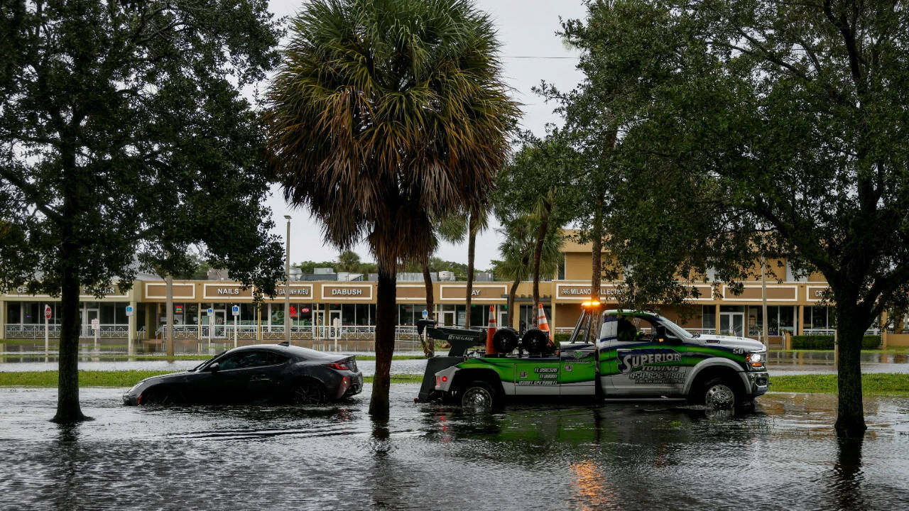
Flood-hit Florida braces for more rain as roads go underwater, schools shut
Key Points
Torrential rainfall has triggered widespread flooding across southeast Florida, submerging roads, inundating homes and forcing emergency crews to carry out high-water rescues as a multiday flood threat continues along the state's Atlantic coast. Parts of the northern Miami metropolitan area, particularly Broward County, have recorded the heaviest rainfall. More than a foot of rain, equivalent to over three Novembers' worth of precipitation, fell in the Hollywood area within a few hours, the...
Torrential rainfall has triggered widespread flooding across southeast Florida, submerging roads, inundating homes and forcing emergency crews to carry out high-water rescues as a multiday flood threat continues along the state's Atlantic coast.
Parts of the northern Miami metropolitan area, particularly Broward County, have recorded the heaviest rainfall. More than a foot of rain, equivalent to over three Novembers' worth of precipitation, fell in the Hollywood area within a few hours, the National Weather Service in Miami said. Some locations received more than 5 inches of rain per hour.
Hollywood's mayor declared a state of emergency and urged residents to shelter in place as flooding forced the closure of sections of Interstate 95 and Florida's Turnpike. The Hollywood police department told CNN that first responders received more than 300 calls for service between 11 pm and 4 am.
Schools shut, roads and airports disrupted
The flooding has disrupted daily life across South Florida, affecting schools, transport and hospital operations. Broward County Public Schools cancelled classes and all district activities on Wednesday and Thursday, while Miami-Dade public schools will also remain closed on Thursday.
Several Keiser University campuses have also shut. The Broward school district said a decision on Friday's classes would depend on weather and road conditions.
Flooded roads have left motorists stranded, with major routes, including I-95 and Florida's Turnpike, among those affected. Flooding also prompted a temporary ground stop at Fort Lauderdale-Hollywood International Airport.
At Memorial Regional Hospital, visitation was suspended, while a synagogue roof collapsed amid the severe weather.
Flooding spreads to Key Biscayne
As heavy rainfall moved south into Miami-Dade County on Wednesday evening, streets in Key Biscayne were left submerged. At least one resident paddled a kayak along a flooded road, while motorists navigated standing water reaching up to 9 inches deep.
Along West Heather Drive, near Hampton Park and around two minutes from Key Biscayne K-8 Center, intense downpours and saturated ground left neighbourhood streets inundated. Water near the curb measured between 8 and 9 inches deep, spilling onto lawns as passing trucks created waves across the flooded roads.
A flood watch remains in effect through Thursday evening, with more heavy downpours, thunderstorms and gusty winds expected. Several rivers in the affected areas also remain high, leaving communities vulnerable to further flooding.
Strong onshore winds and high surf are expected to affect Florida's coast over the coming days, potentially bringing dangerous rip currents and significant beach erosion.
Florida faces three more days of flood risk
Florida's eastern coast faces three consecutive days of a Level 3 out of 4 flood risk through Friday.
Between 3 and 6 inches of rain is expected across eastern Florida through Friday, while some areas along the state's eastern coast could receive 8 to 12 inches or more. Daytona Beach could receive around a foot of rain, equivalent to four Novembers' worth of precipitation in just a few days.
Forecasting which communities will record the highest totals remains difficult, as much depends on where storms develop and whether they remain over the same areas, bringing torrential rain for several hours.
Melbourne, Florida, which experienced historic rainfall earlier this month, is among the areas facing the highest flood threat on Wednesday and Thursday. The city recorded its wettest day on record on November 2, when 11.5 inches of rain fell. It is now around 7 inches short of its wettest year on record, a mark it could reach during this week's storm.
By Friday, the Level 3 flood risk is expected to extend farther north, towards areas near the Florida-Georgia state line. Rainfall rates could exceed 2 inches an hour, adding to the previous days' totals and increasing the risk of serious flooding.
Wetter-than-normal conditions in Florida this autumn and winter are not unexpected as the super El Niño continues to strengthen, changing global weather patterns and increasing storm chances across the US Southeast.
Storm may disrupt pre-Thanksgiving travel
After drenching Florida, the developing storm is expected to move north, potentially disrupting travel during the busy pre-Thanksgiving weekend.
It is likely to remain off the Southeast coast until Saturday, when it will begin moving farther north. Its impact along the East Coast into early next week will depend on its path, which forecast models are still assessing.
Two scenarios are currently favoured for the storm's movement after Florida, and either could affect travel from this weekend. Last year, the weekend before Thanksgiving was among the busiest travel periods of the holiday week, according to Transportation Security Administration screening data.
Florida (LOCATION)
Atlantic (LOCATION)
Miami (LOCATION)
Broward County (LOCATION)
Hollywood (LOCATION)
the National Weather Service (ORG)
Interstate 95 (LOCATION)
CNN (ORG)
South Florida (LOCATION)
Broward County Public Schools (ORG)
Miami-Dade (LOCATION)
Keiser University (ORG)
Broward (LOCATION)
I-95 (LOCATION)
Turnpike (ORG)